DISTANCE

Manali - Spiti - Kinnaur

11 nights/12 days


MIN. GROUP SIZE
8

ELEVATION GAIN
M

MAX ELEVATION
4600M

% UNPAVED
75%

% SINGLE TRACK
%
Itinerary
Day 1: Arrive in Manali (spot elevation: 2050 m)
- All riders will gather in Manali. Spend the evening getting acquainted with your fellow riders. Hang out at the dreamy little cafes across town, many of which have views of the idyllic mountains around.
Day 2: Acclimatization, gear checks, and local ride (spot elevation: 2050 m)
- Gear check and last-minute preparations, if any.
- Local ride to Solang to get acquainted with your bike, and get acclimatized before climbing further up the mountains.
- Time permitting, in the evening you can unwind in the hot springs of Vashisht village across the Beas River, or visit the medieval Naggar Castle nearby.
- Go to bed early and rest well, so you can start your tour refreshed the next morning.
Day 3: Manali - Marhi (spot elevation: 3360 m)
- The journey starts from the smooth roads of Manali, surrounded by pine and deodar forests. We follow the meandering route along Beas River, taking a series of hairpin bends. Steadily ascending, enjoy scenes of the Himalayan foothills, as you cycle through the villages of Palchan, Kothi and Gulaba. This stretch is dotted with several small waterfalls and viewpoints. Upon reaching the lush alpine meadows at Marhi - the base of the Rohtang Pass, we camp there for the night.
- Distance: 35 km, Cumulative Elevation Gain: 1600 m, Loss: 200 m
Day 4: Marhi - Chatru (spot elevation: 3560 m)
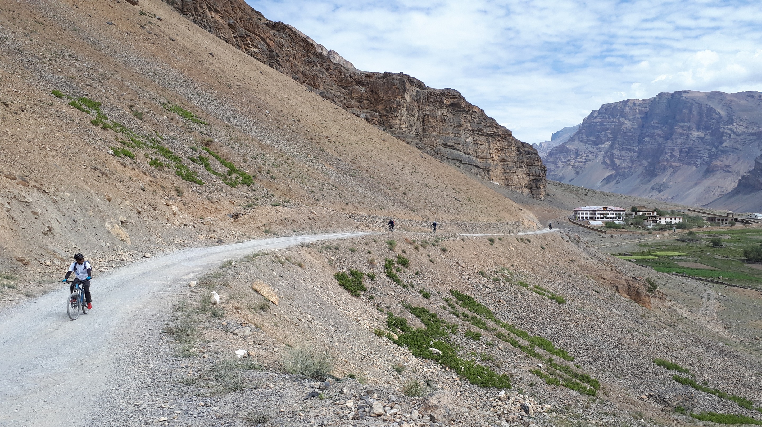
- We begin our day with a steep climb to the top of Rohtang Pass which lies at nearly 4000m. The descent from the pass is the beginning of the mix of metalled and unmetalled roads that we go on for the rest of the tour. At Gramphu, we take the fork towards Spiti and follow the Chenab River to reach the campgrounds at Chhatru.
- Distance: 50 km, Cumulative Elevation Gain: 1100 m, Loss: 1000 m
Day 5: Chatru - Batal (spot elevation: 3900 m)
- We continue along the Chenab River, passing by small waterfalls, and riding through many nallas (streams) enroute, including the infamous Pagal Nallah (Mad Stream). You will enjoy expansive views of the Chandra Bhaga mountain range as we make our way to Batal. The Chacha-Chachi Dhaba here is popular for meals and traveller stories. Consider stargazing at Batal as you spend the night here.
-
Distance: 30 km, Cumulative Elevation Gain: 900 m, Loss: 250 m
-
Distance: 30 km, Cumulative Elevation Gain: 900 m, Loss: 250 m
Day 6: Batal - Hansa (spot elevation: 3700 m)
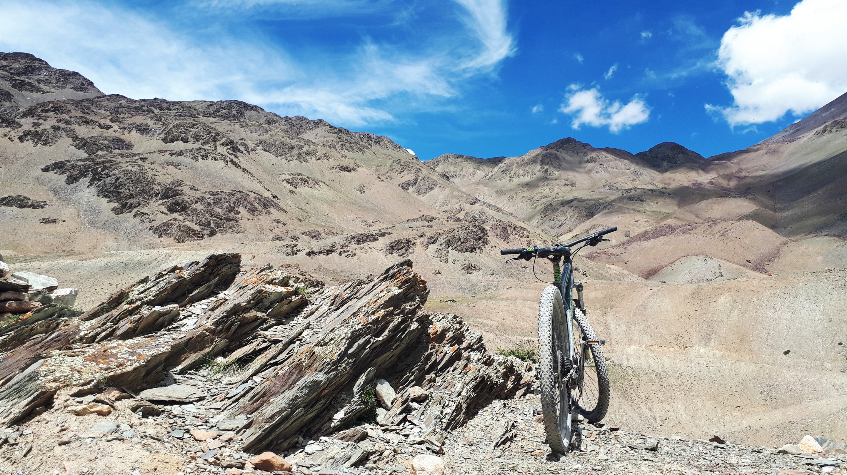
- Brace yourselves as this will be our hardest day on this tour. Starting the day at Batal, we head up the steep road to Kunzum Pass (4551 m), which is the gateway to Spiti Valley. We spend some time at the pass to take in the magnificent views of glaciers and mountains around. You can also drop by the Kunzum Mata temple to seek blessings for the rest of our journey. Enjoy the descent all the way to our camping spot at Hansa. Enroute, the spectacular scenery of Losar village is a fitting welcome as we enter Spiti Valley.
- Distance: 42 km, Cumulative Elevation Gain: 900 m, Loss: 950 m
Day 7: Hansa - Chicham - Komic (spot elevation: 4587 m)
- We begin the day from our camp at Hansa and at the entry gate of Kibber Wildlife Sanctuary, we will veer off to get onto a small dirt road that offers magnificent vistas of the Spiti Valley, before we reach the picturesque Chicham village. Further ahead, we cross over to Kibber village via the Chicham Bridge - the highest bridge in Asia.
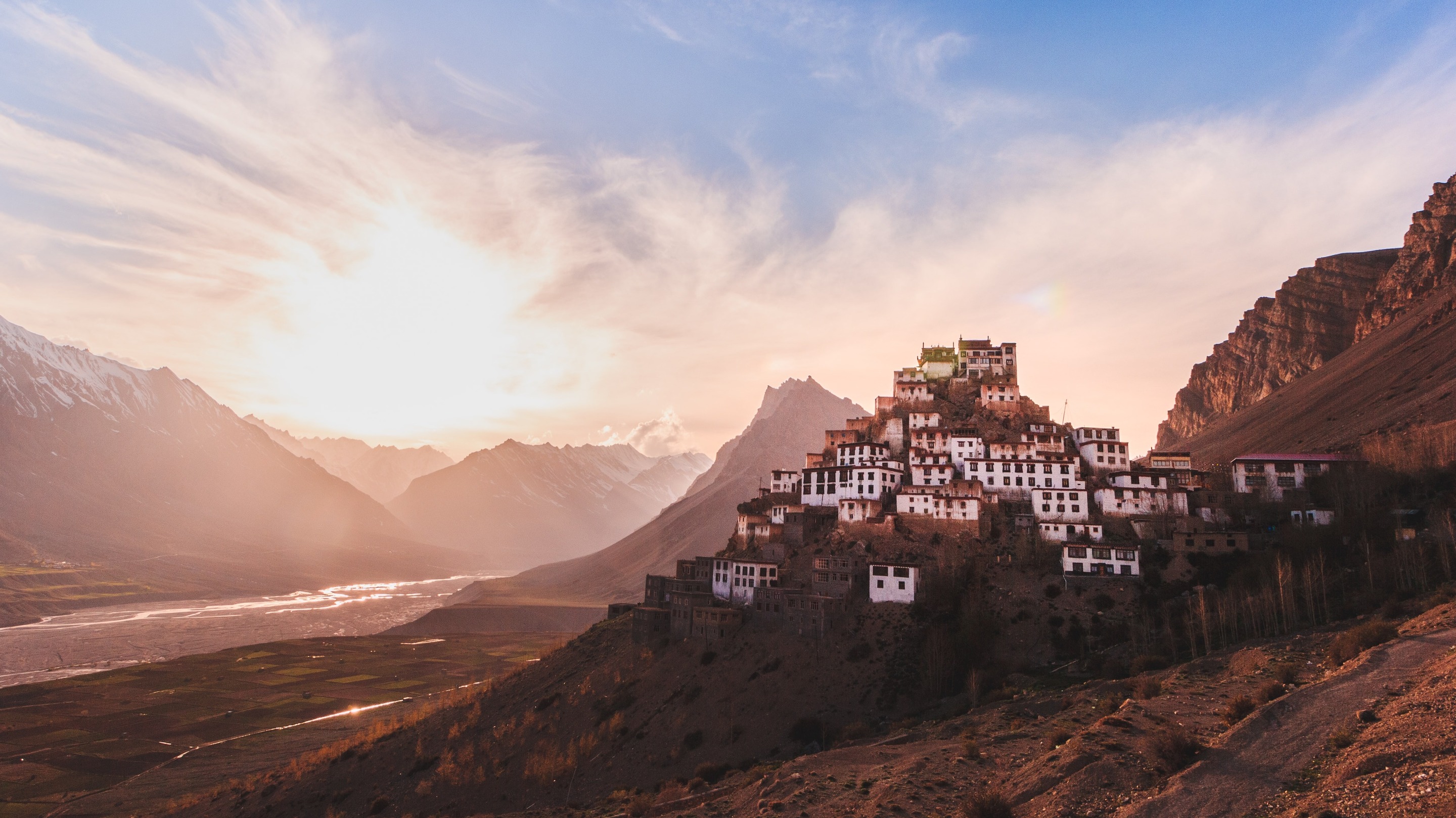
- At Kibber, we will visit the iconic Kee Gompa which is perched atop a monolith hill overlooking the Spiti River. We get to interact with monks and explore the monastery that houses thangkas (scrolls), wind instruments and weapons.
- We then descend from Kibber and soon turn onto a dirt trail near Kaza to head up to Hikkim village where you can visit the world’s highest post office. From there we make our way up to Komic, which is currently the highest village connected by a motorable road.
- Distance: 65 km, Cumulative Elevation Gain: 2000 m, Loss: 1500 m
Day 8: Komic - Tabo (spot elevation: 3400 m)
- Today, most of your riding will be downhill on dirt tracks. We will pass by pastures near the pretty hamlet of Demul, before connecting to the main road alongside the Spiti River. You can see the confluence of the Spiti and Pin rivers at Samling, and then continue to Tabo.
- Distance: 65 km, Cumulative Elevation Gain: 1100 m, Loss: 2350 m
- After the ride, a must-visit attraction is the Tabo Monastery, which is India's oldest operational monastery. You can browse a treasured collection of Indo-Tibetan style art, including murals and stuccoes, at the museum. Housing a few small mud temples and structures, the courtyard terrace overlooks the village and the Spiti River.
- A 15-minute hike away are the Tabo caves, perched on cliffs above the monastery, where resident monks usually meditate. The serene atmosphere of this picturesque monastery will be etched in your memory.
Day 9: Tabo - Nako (spot elevation: 3662 m)
- Segment 1(half tour) participants will exit from Tabo
- The full-tour participants will continue on to Nako. Expect a hard day of riding on this stretch of the India-Tibet Road, which involves a strenuous ascent to Malling Nallah, and then a relatively short descent to Nako.
- Distance: 65 km, Cumulative Elevation Gain: 1800 m, Loss: 1450 m
- The quaint village of Nako is set against a beautiful backdrop of the Reo Purgyal mountains. Take a walk on the rustic streets and drop by the Nako monastery on the upper reaches of the village. You can end your day relaxing on the shores of the calm and sacred Nako Lake surrounded by willow and poplar trees.
Day 10: Nako - Spello (spot elevation: 2500 m)
- Enjoy an easy day on downhill and flat roads in the Kinnaur Valley. First, ride along the Spiti River and then along the Sutlej River after crossing the Khab Sangam bridge. You can take a break midway at the picturesque village of Pooh, nestled amid orchards and vineyards.
- Distance: 62 km, Cumulative Elevation Gain: 1500 m, Loss: 2800 m
Day 11: Spello - Kalpa (spot elevation: 2960 m)
- On the final day of this tour, you will first ride along the old India-Tibet road, enjoying scenes of the Sutlej River valley. Turn off the highway to reach Kinnaur's district headquarters Reckong Peo. Finally, make your way up to the picture-postcard village of Kalpa, on steep winding roads flanked by deodar trees, apple orchards, and terraced farms. Soak up breathtaking vistas of the holy Kinnaur Kailash peaks as you reminisce about riding in the mountains.
- Distance: 45 km, Cumulative Elevation Gain: 1800 m, Loss: 1200 m
- While in Kalpa, observe the blend of Hindu and Tibetan cultures. Notable attractions here include the Narayan Nagini Temple, Hu-Bu-Lan-Kar monastery, and the Sapni Fort. Don't miss out on savouring the delicious Kinnaur apples!
Day 12: END OF TOUR
- Return home from a convenient airport, or head onward to another destination.
Accommodation
When in Manali, Komic, Tabo and Kalpa, we will provide comfortable accommodations and facilities in homestays/hotels.
On other tour days, we will set up camps on scenic open grounds with all possible facilities. The camps will have toilets, kitchens and dining areas and will be run by trained, professional staff, including a chef.
On other tour days, we will set up camps on scenic open grounds with all possible facilities. The camps will have toilets, kitchens and dining areas and will be run by trained, professional staff, including a chef.
FAQs
What's included in this tour?
1. Tents, Sleeping bags, Carry mats and access to Mess Tent
2. Nutritious, high-calorie food will be served
3. Guides, cook and camp helpers
4. Logistics and support vehicles such as a Tempo Traveller to carry all our equipment. You will only have to carry your personal knapsack containing a water bottle, camera and trail layers.
5. Hotel accommodation in Manali, Komic, Tabo and Kalpa
6. Tents on double occupancy on other days of the tour
What's not included in this tour?
1. Any expenses of personal nature
2. Food expenses in Chandigarh/Manali and Kalpa/Chandigarh before and after the tour
3. Mountain bike (You will bring your own bicycle or opt for the rental add-on)
4. Personal and gear insurance
5. Transportation on tempo/bus/cab from Chandigarh (or elsewhere) to Manali and Tabo/Kalpa to Chandigarh (or elsewhere)
0 reviews
0
5 Stars
0
4 Stars
0
3 Stars
0
2 Stars
0
1 Star




.jpg)
